Canvey Railway and Model Engineering Club.
|
|
Thames Estuary Airport |
09-07-23 |
Thames Estuary Airport
In 2012 the Mayor of London Boris Johnson was proposing to build an airport south of the Thames Estuary between Kent and Canvey Island. The concept was to flatten the hills of Kent and use this land to build out into the Thames Estuary. The author of this article submitted an alternative concept in an attempt to minimise conflict with the existing inhabitants of the area.
The BJ proposal has safety problems to that have to be resolved; the biggest one being that Southend Airport has a flight path directly across the proposed site. (In all probability Southend Airport would be closed) There is the risk that the Calor gas storage facility on Canvey Island could also be a problem.
One of the biggest problems anyone has living around the Thames Estuary is flooding; the proposed plan should incorporate a flood defence barrier. This will not only benefit the local community but benefit everyone that would be flooded from the Thames. Looking at the entire project there is one property that needs to be demolished and that property is at the end of the C2C line at Shoeburyness. It will be necessary to demolish this one property to take the C2C line out to meet the barrage.
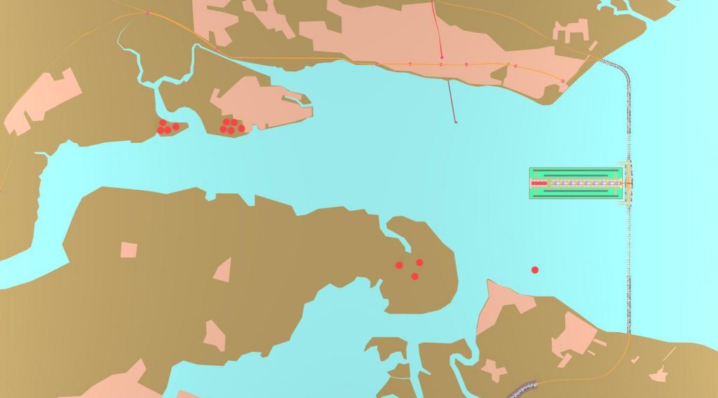
Overview of the Thames Estuary
Working from the assumption that nobody wants an airport on their doorstep how can we limit the impact of such a proposal? The obvious solution is to place the airport as far out as possible and in the middle of the Thames Estuary.
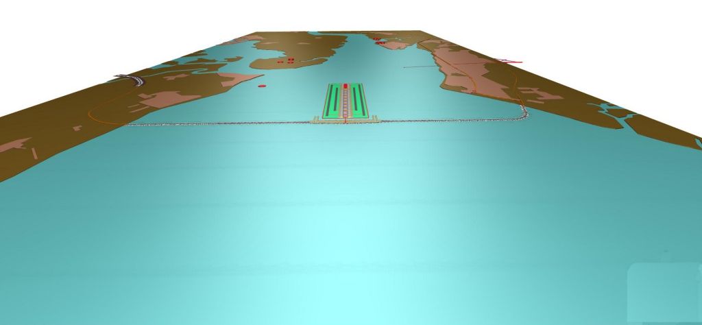
Approaching the Thames Estuary Airport
If we are building a flood defence barrier across the Thames then the possibility of using this barrier to generate electricity would be a good addition to the proposal. The normal approach to generating electricity would be to store the water and release it gradually over time. This would hinder ship movement and also cause the river to silt up. With a hydroelectric scheme that can work on a difference in height of only 100 mm the principle of using flow not pressure makes the scheme possible.
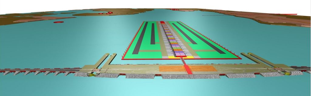
A view of the proposed flood gates, locks, station and airport
Looking at the central section of the barrage you will see the two locks either side of the airport. There are bascule bridges for the road and rail networks and on the sea wall side there are two massive circular gates to protect against flooding.
Proposed shipping locks with flood defence gates and bascule bridges for road and rail
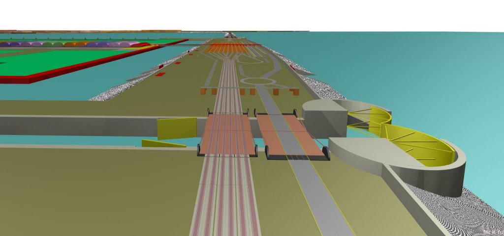
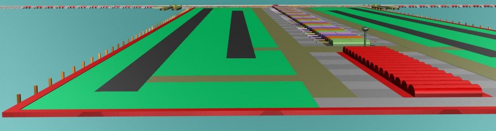
The floating airport is connected to the barrage and takes you immediately to the train station, light rail and short-term parking. Long term parking is accessed by a light rail shuttle service taking you from the airport station to Shoeburyness or the Isle of Sheppey.
The old MOD site at Shoeburyness is an ideal site for all the ancillary equipment and parking.
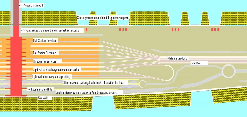
Overview of the proposed station and short stay car parking
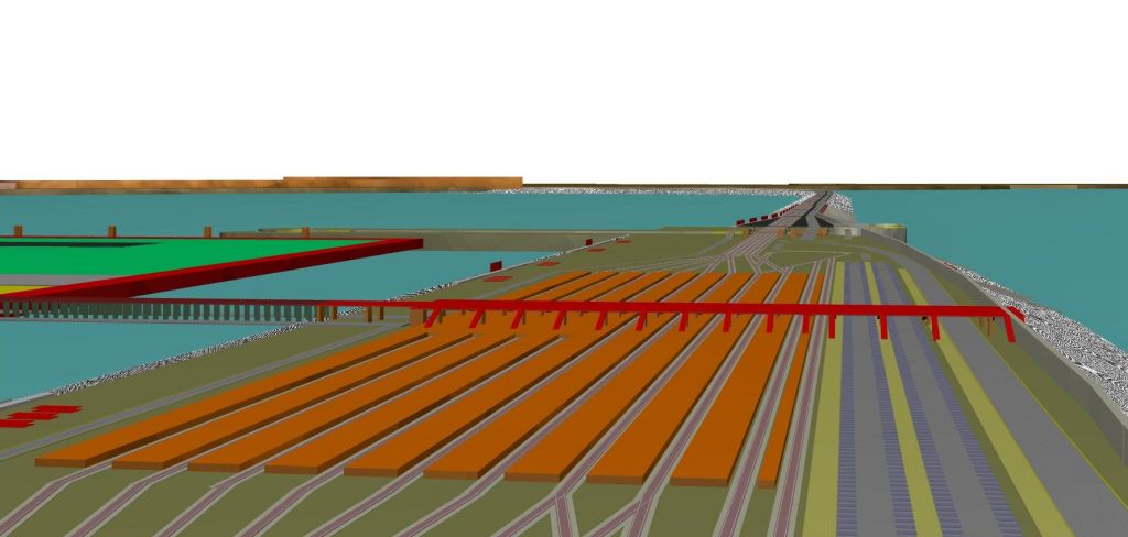
View of airport from the West end ( London end )
The above view shows the West end of the airport. To the extreme left you can see the piles that hold the airport in place then we have the two runways, taxiway and the airport stands and terminals. The buildings in red are for freight traffic and airport services. Towards the top of these red buildings you can see the airport control tower.
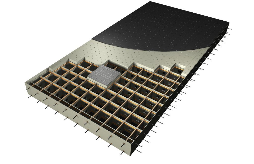
One of the pontoons cut into sections
The airport with its runways and terminals is made up of floating pontoons with the pontoons held together with cabling held under tension. This entire block is held in place with piles. Each individual pontoon has pipes that goes from the very top to the very bottom of the pontoon. This enables rainwater to flow away rapidly and also allows access under the pontoon so silt levels can be monitored and disposed of if necessary.
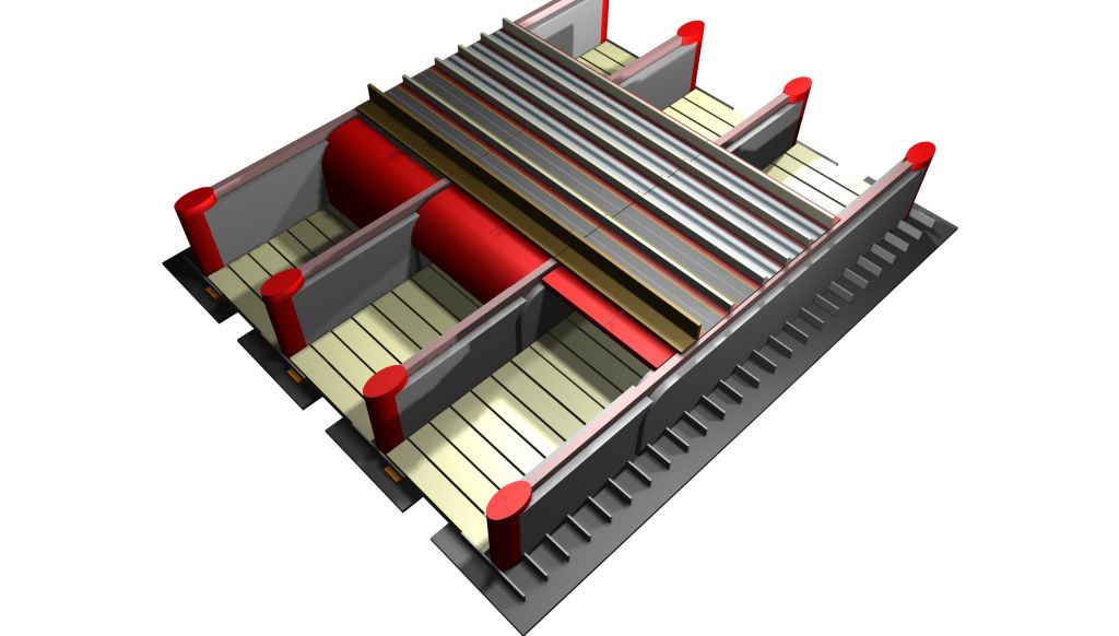
Flood defence gates.
The above drawing shows the proposed scheme for the dam gates. You will immediately notice that there are no foundations included. As we are having to build on clay this is a very specialised engineering skill. To build the structure immediately on clay could lead to catastrophe. My initial idea without further consultation is that the whole structure would be constructed on a thick layer of ballast. This idea may seem illogical as it would allow sea water to seep through but it cannot be broken down in the same way the clay can. The red ovals at each end of the peers are the only fixture that penetrates through the clay into bedrock. These piles stop the peers from tilting and hold them in position. To compensate for the clay foundations the peers are extended lengthwise. Not only does this give greater stability but it allows for the floodgates to be rolled out horizontally so they can be serviced. At the rear of the gates this space allows for the possibility of hydroelectric schemes to be installed. The cream coloured blocks will be concrete blocks that are not fixed into position therefore they have some amount of movement. They can also be withdrawn and replaced if they wear out. The entire structure is constructed in a way that it can move slightly and still function. On top of the flood defence scheme you will see the sea wall, two dual carriageways, railway tracks for a light rail system and railway tracks for the mainline system. The flood defence gates are kept under this infrastructure when not required.
|